007 – Cape Infanta Trig Beacon (6km / 80m Elev)

For a while I’ve had the idea that it would be cool to do some portable radio stuff from the southern most tip of Africa (Cape Agulhas) – There’s two problems with this: 1. My holiday house is much closer to Cape Infanta, and 2. Cape Agulhas is a bit boring since it’s basically a parking lot that you can drive to.

20190104_062910.jpg

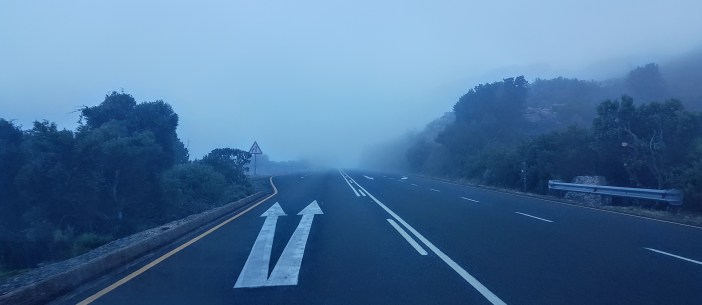
I try to get out as early as possible. My current thinking is try and be walking before sunrise to maximise on the cooler hours for hiking and get some great photos.

20190104_062912.jpg

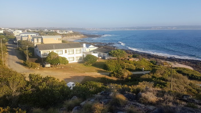
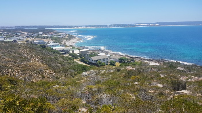
As usual I left planning to the last minute, so didn’t have a clear idea of what the route would be. I left home around 5:30 and drove the 40km to the sleepy Village of Cape Infanta around 6am. It was just after new years, peak holiday time, and every second home had a lawn strewn with children’s bicycles left overnight in perfect safety.  It was strangely heartwarming to see that.

20190104_063736.jpg

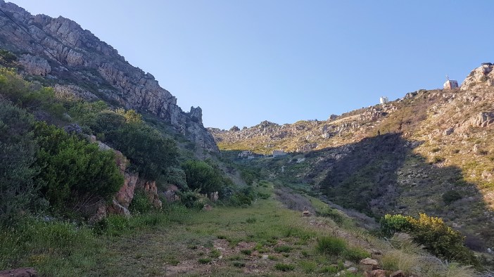
Because I didn’t have a plan, I just drove to the corner of the village that was closest to where I wanted to be hiking and parked. There was no clear path up onto the hill but I’m used to bundu bashing and pushed my way through some reeds, a dry riverbed and up the opposite embankment and started walking towards the part of the map that I thought was most interesting.

20190104_214426.jpg

20190104_064201.jpg

In hindsight I now know that there is an official start to this hiking trail that boringly has a “designated parking area” and actual “walking paths”, but I regret nothing. (really I don’t, I enjoy not knowing what to expect around the next corner).

20190104_065431 (1).jpg
Breccia (see Wikipedia)

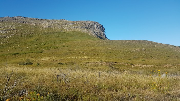
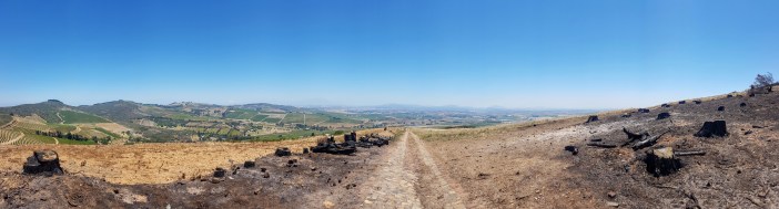
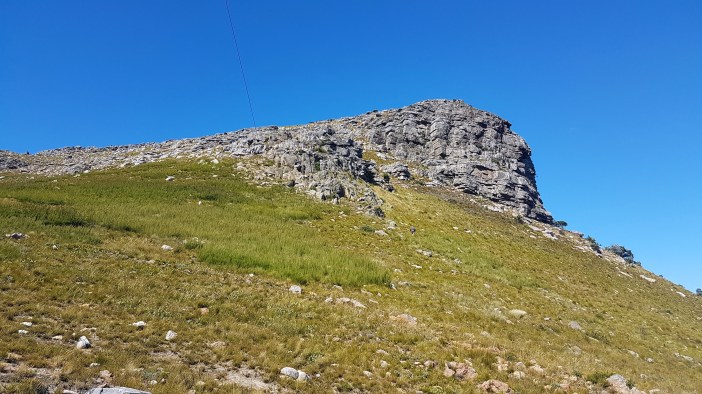
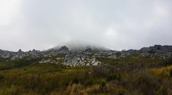
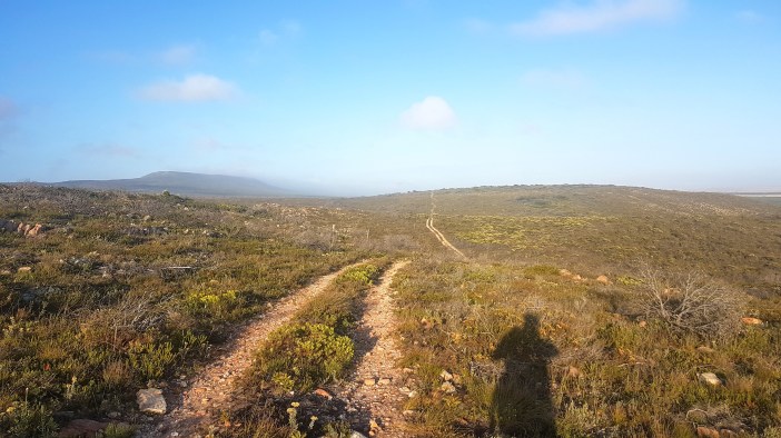
I clambered up the hill, heading in an easterly direction towards the “Cape” and eventually spotted a gravel road in the distance and headed for that.

20190104_083149.jpg

Once on the road the pace picked up and I realised that I was likely following a trail that went right to the spot I’d intended to go to. The walk was lovely and cool. The gravel road eventually petered into a single trail, the sun in my face lens-flaring the hills ahead. Magnificent!

20190104_065304.jpg

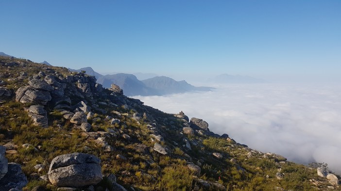
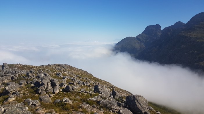
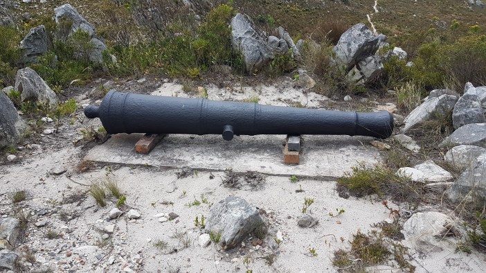
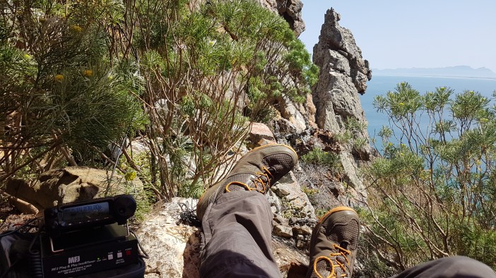
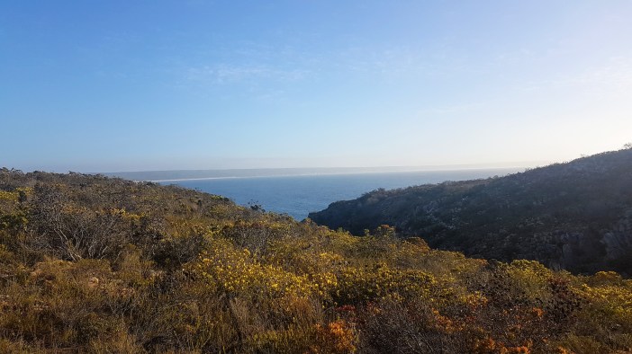
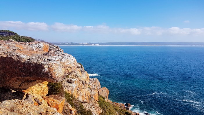
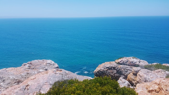
Eventually you reach the sea, the trig beacon, the magnificent cliffs and the water which seemed to be painted with 5 different shades of blue making you think it couldn’t possibly be as cold as you know it really is.

20190104_072234.jpg

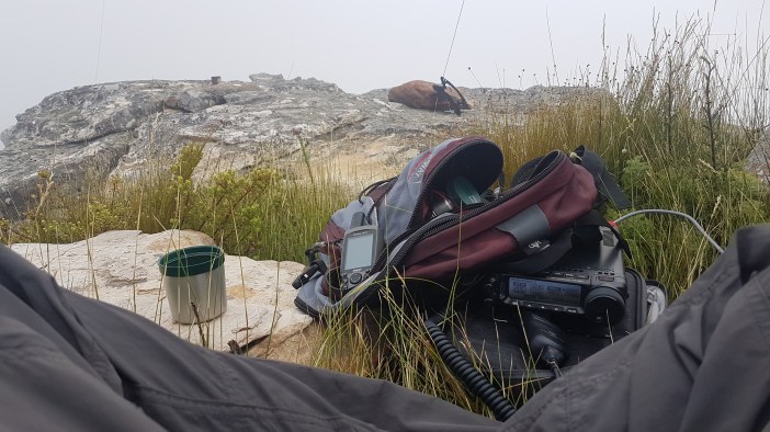
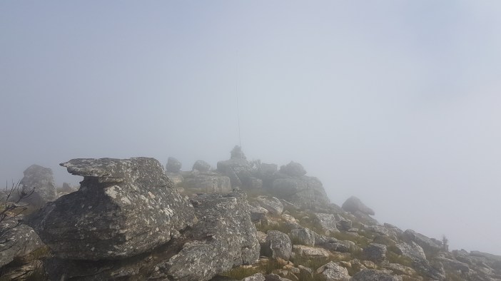
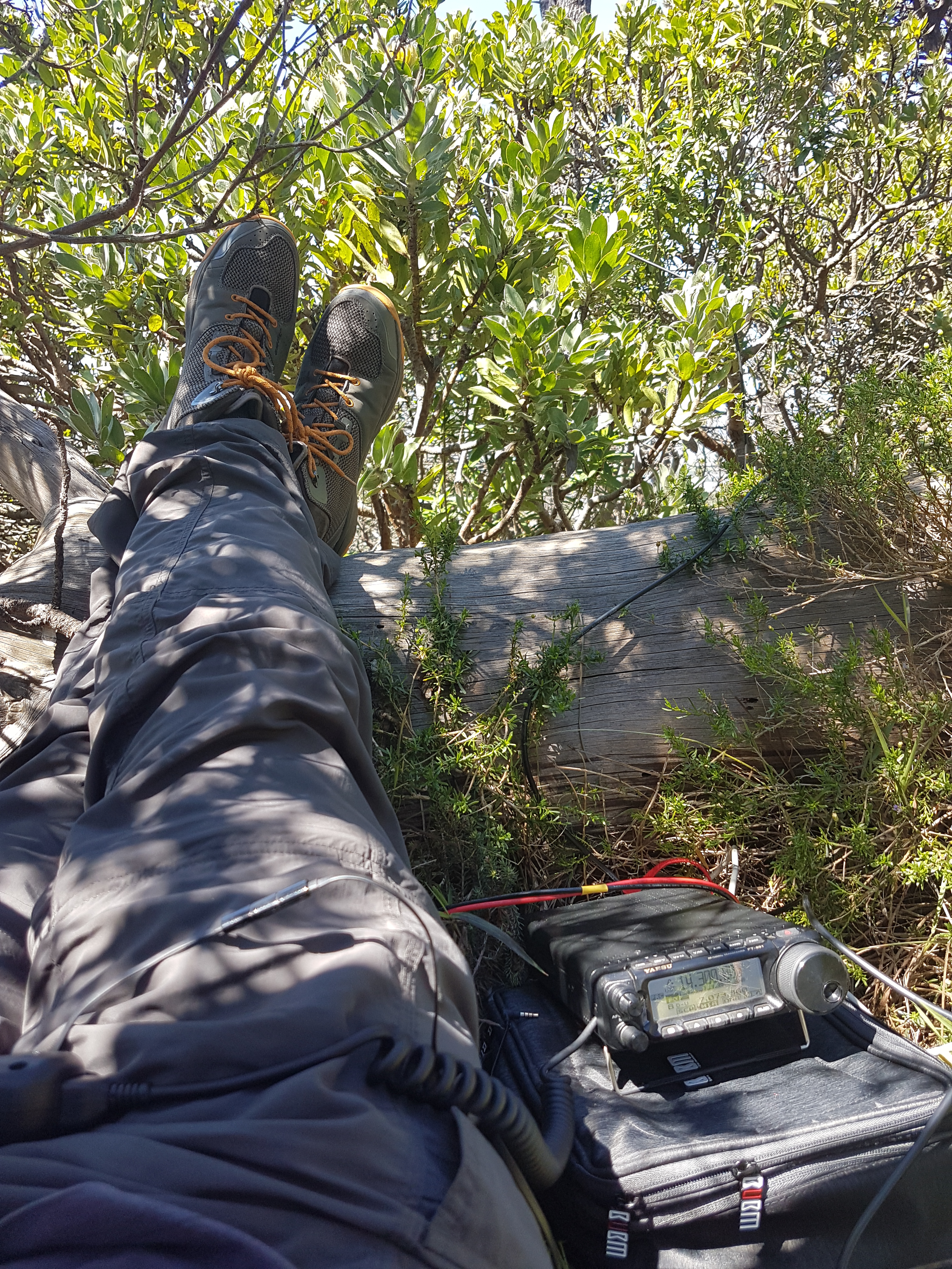
I set up my antenna on the trig beacon and ran my antenna cables to the flat rocks overlooking the sea. From here I listened to some Americans chatting and tried to make contact, but I just wasn’t getting out. (I’ll explain this in a future post, but bursts of energy from the sun can take my tiny little signal and boost it along the troposphere and deliver it to someone in America as if I was just down the road, or not, most often not).

20190104_214659.jpg

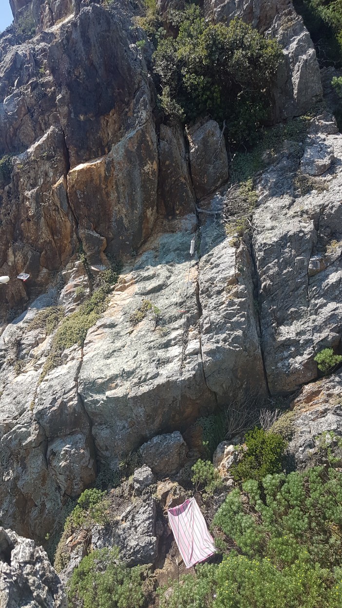
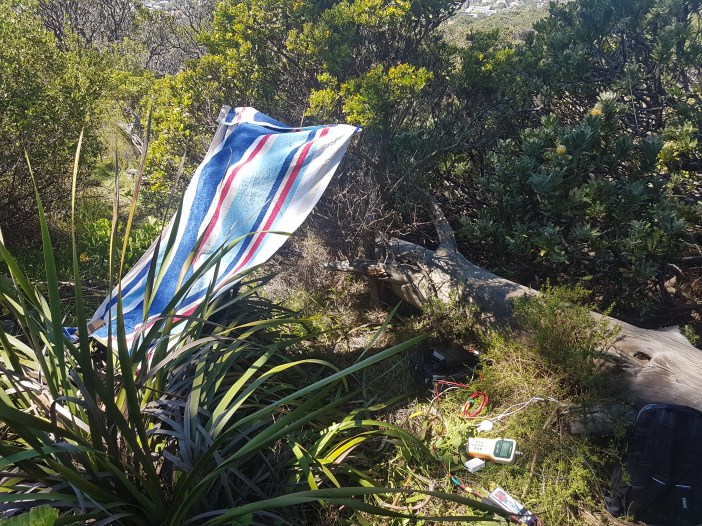
There were plenty of South African’s chatting on other frequencies and I listened in as I scouted out the area trying to figure out how I was going to set up a shelter to avoid getting sunburnt. Eventually I relocated away from the cliffs and set up my little tarp in some small shrubs that I could sit under. It was barely 8am and I could tell it was going to be a stinker of a day. I’ve learnt that it is important to build a shelter before things get hairy, a few hours later when you’re already burnt and dehydrated is not the time to be engaging your cognitive abilities to construct some shelter. (Often because you just couldn’t be assed by that stage and instead get roasted by the sun)

20190104_082953(0).jpg

20190104_082316.jpg

20190104_110354.jpg

After speaking to a few people from Africa, I switched to digital modes (JS8Call) and immediately, almost surprisingly, made contact with an Australian station. This was my first time “talking” to Australia and it kind of made sense, since I was on the East cost. This was the start of a few hours of testing one of the cooler features of JS8Call, the ability to relay a message from one station to another. Through the Australian station I was able to talk to a station in the Philippines, and technically we would be able to relay that message further, hopping via ham radio operators on every continent on the planet.

This might seem like a weird thing to do, but as an experiment it highlights how you could be pretty much anywhere on the planet and be in contact with anyone else on the planet with only kit you’re both able to carry on your backs (and not using satellites). Some radio people will tell you this is important in case of a global catastrophe where all the communications satellites are shut down by a foreign superpower. I’ve made peace with the fact that it’s just super nerdy and fun and I don’t need to rationalise my hobbies to anyone.

20190104_114351.jpg

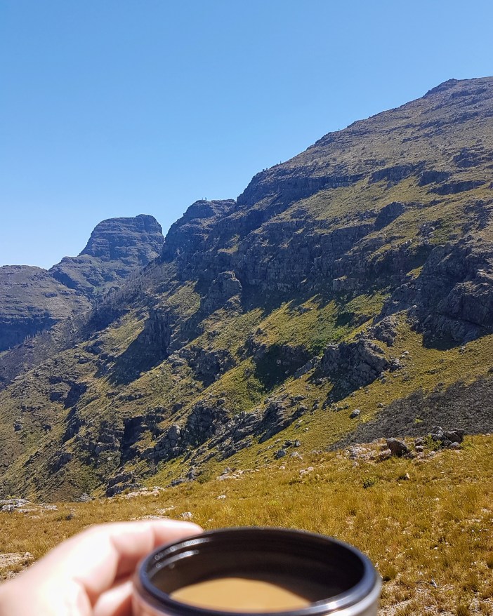
As usual, coffee and batteries eventually ran down and spent around 30 minutes packing up and appreciating the view before heading back to the car.

20190104_123809(0).jpg
Cape Infanta looking pretty


Summary

Date: 4 January 2019
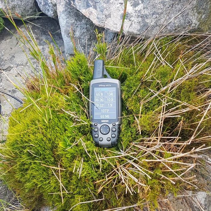
Distance and Elevation: 6km and 80m Elevation Gain.
Coordinates: My Parking spot -34.424086, 20.8561665  Trig Beacon: -34.429609, 20.8671564   The correct starting point: -34.422157, 20.8524268
Conditions: You are quite exposed at the trig beacon so ensure you take some form of shade or don’t plan to hang around very long.
Radio Stuff: You’ll definitely need a mast, take some straps to attach it to the trig beacon.
Notes: It’s probably a good idea to do a little bit of Google Earth research before setting out on a mission like this so that you don’t end up bashing through riverbanks to get to where you want to be.


Advertisement

006 – DuToitskloof, but higher (2km / 200m Elevation)

Ever since 004, the micro-mission to DuToitskloof I’d been wanting to return and climb up the very obvious little “koppie” that was right there. The weekend rolled around and I almost decided not to go out, but at the last minute on Saturday night I started packing my bags for the morning. I’m so glad I did.

20181223_070847 (2).jpg

The road was misty, as I ascended up the old pass I was surrounded by thick mist. This had me slightly worried about it all being a miserable slog, but I pushed on. Eventually I popped out the top of the mist and could still kick myself for not stopping to get a photo. A blanket of fog filled the valley but the air above the surface was bright and clear.

20181223_071513.jpg

I parked at my usual spot and headed up the hill. My initial plan was just to find a route to the top right hand corner. There are no paths up here but luckily the terrain is relatively easy to traverse as long as you zig and zag enough, and where you need to climb it’s fairly easy to find a route that doesn’t require doing anything too stupid.

20181223_072936.jpg

20181223_072952.jpg

20181223_073924(0).jpg

As you scramble up there rocks there are various “false summits”. You see what looks like the top and climb to it, and then when you’re there you see there is a another one a few minutes scramble away. The entire time the view is getting increasingly spectacular.

20181223_074012.jpg

20181223_074349.jpg

Eventually things flatten out into an undulating plateau that seems to go on forever. (This is the Hugenot Ridge, a 3 km spine of mountain in an almost straight line… which has made it onto the list for future adventures)

20181223_074543.jpg

20181223_074603.jpg

20181223_074604.jpg

Once on the plateau things, err,  flatten out and you can basically just take a stroll with the occasional scramble that requires using a hand to steady yourself. I truly felt like I had found something secret. A little world that was was hidden in plain sight, just off the road, but I was a million miles from everyone.

20181223_074903.jpg

I kept walking towards the obvious “highest” point and when I was close enough realised that it was a rock cairn, possibly a minor surveying point but maybe just erected by enthusiastic hikers.

20181223_082559.jpg

The cairn offered an obvious spot to erect my mast and with the warmth of the sun baking through the chill, and absolutely no wind I decided to make this place my home for a few hours.

20181223_082642.jpg

20181223_082812.jpg

20181223_085046.jpg

Getting the mast up was pretty quick. I’m getting good at that. I did notice that it was starting to feel a bit chilly. The mist was rolling in… It made me a little bit nervous, but the route down was relatively straightforward and in a worst case scenario I had a GPS track I could double back on.

20181223_090506.jpg

The radio’ing was great. I chatted with all the usual suspects including some Namibian guys on 40m and then decided to switch over to 20m where to my amazement I was hearing foreigners chatting quite clearly (which is sometimes a sign that they might hear you. It worked. In a matter of minutes I had spoken to a guy in Northern Italy, a guy in the Congo and another guy in Brazil. Incredible, and all while surrounded with fog!

20181223_090527.jpg

20181223_090705.jpg

The fog was thick enough that I had to start covering my kit. I hike with a large lightweight waterproof tarp that usually serves as a roof when the sun is baking down, but can also be used as a cover over my kit with a few rocks holding it down and creating an opening so that I can still read the display etc.

20181223_092556.jpg

I spent a few hours up there with my coffee and rusks, and a sandwich when I felt hungry. I can easily imagine spending the night up there if I could find a flat enough spot to make a bed. My clothing was damp from the fog, but not enough to be uncomfortable. I now hike with a compact raincoat for such occasions.

20181223_122304.jpg

Eventually my coffee ran out, and my battery beeped its low voltage alarm, and I decided to pack up and head back. The weather seemed to be playing along, clearing during my pack up and opening up the view for me on the way back down.

20181223_123612.jpg

20181223_123441.jpg

And this is why I have a new saying: “I’ve never regretted a hike”, and to think, I was contemplating spending the day on the couch!

Summary

Date: 23 December 2018
Distance and Elevation: 2km and 200m Elevation Gain.
Coordinates: Parking spot -33.696697, 19.074741  Rock Cairn: -33.700637, 19.071358
Conditions: Heavy fog rolled in, make sure you take a waterproof shell. I imagine it could also be blisteringly hot with gale force winds, possibly on the same day. Be prepared.
Radio Stuff: You’ll definitely need a mast, great location for radio.
RouteKML File (approximate)
Notes: Don’t ever debate hiking.

005 – Bottelary – (4km / 230m Elev)

Botterlary is one of those “mountains” that is used extensively as a commercial RF high-site. It was my first time up here and because I’m a  huge nerd it was interesting to see how it was all laid out, but predictably it is not a great location for sensitive radio experimentation.

20181216_080900.jpg
Pretty walk up the hill

I met up with a few friends at Koopmanskloof Winery (who had kindly given us permission for the day). We drove Brian’s Landy a few hundred meters up the hill until we reached a boom across the road and parked out of the way. We then trekked the rest of the 2km up to the top of the hill. You should eat breakfast before you do these kinds of things. I of course hadn’t eaten breakfast and felt like dying a few times on the way up. It’s an unforgiving slog.

20181216_090532.jpg
There’s probably 50 of these towers

It is however still a pretty walk, and once you reach the top you’re surrounded by antennas and small buildings humming away ominously.

We set up in the shade of one of the small buildings and I did actually manage to make contact with one person who was only a few km away. There was an S9+ noise floor, which for non-radio people basically means so much interference that any signal that wasn’t absolutely booming in would not be heard over the noise.

20181216_094824(0).jpg
Original location

I made the executive decision that we should move downhill, away from the towers and set up again to see how thing fared a short distance away.

20181216_114952.jpg
The new location with all the trappings of civilisation

The new location was much better noise wise; down to S3 and we immediately started making contacts with people all over the country.  The surroundings were a bit spartan though, and a recent fire had made it even more so. My lack of breakfast continued to diminish my enthusiasm and we packed up as soon as we’d made enough contacts to consider the SOTA summit activated.

20181216_122918.jpg

Overall a fun outing, but there’s definitely other hikes to do before this one.

Summary

Date: 16 December 2018
Distance and Elevation: 4km and 230m Elevation Gain.
Coordinates: Parking spot Koopmanskloof Winery (get permission!)  Setup Spot: -33.9079654, 18.7720508
Conditions: Quite hot on the day, very little wind. Take lots of water.
Radio Stuff: Obviously the actual summit is noisy. There are some tall bluegum trees on the way up that would be great for an end-fed or possibly even stringing up a dipole.
RouteKML File
Notes: Your mom was right, breakfast is important.

004 – Dutoitskloof One (MicroMission) <1km

I am really only including this as a blog post so that I can highlight how great a location this is for radio amateurs who want to test their setup in the great outdoors without committing to a crazy hike. From where you park your car to a large, relatively flat open space, is a 300m walk uphill. Just enough to get your heart pumping but still close enough that you might carry something stupid like a table or camping chairs. (I did neither)

20181209_081303.jpg

20181209_112322 (1).jpg

20181209_093422.jpg

What is great about these micro-missions is that they give you an opportunity to look around and think about what might be a great hike, what mountains are around you etc.

For the non-radio-nerd readers, check out hike number 006 where we return to these mountains but climbing up to the top for amazing views.

20181209_095430.jpg
Soon I will come for you too.

Summary

Date: 9 December 2018
Distance and Elevation: <1km and 30m Elevation Gain.
Coordinates: Parking spot -33.696682, 19.074776  Setup Spot: -33.697215, 19.073074
Conditions: Cool with a fresh breeze bordering on “windy” earlier on, but then later hot and very calm.
Radio Stuff: You’ll need a self supporting mast as there are no trees. While technically you’ve got mountains on most sides, you still have great elevation which should give you some great takeoff North and South. There are big power lines running through the valley to the east, but I didn’t pick up any noise.
Notes: The parking spot is quite exposed but with lots of traffic I think it’s pretty safe.

003 – Gantouw Pass (6km / 150m Elev)

This is one of those truly magic hikes that inspire you to keep exploring because you never know what’s just around the corner.

20181202_074050.jpg

I am fascinated by this part of the mountain. There is a train line that most people don’t know exists, you can touch wagon wheel tracks carved into the rocks hundreds of years ago by the voortrekkers, there’s a canon that was used to notify people when someone had made it to the top, and last but not least, there’s a creepy old train tunnel that runs directly under the N2 at the top of Sir Lowry’s pass for the train you didn’t know about.

20181202_080344.jpg
Looking back

If I had another lifetime I would spend it documenting the incredibly fascinating micro-history of South Africa. The past of seeming insignificance gives history its texture. Knowing these little stories lets you find wonder in the smallest things. A groove cut into a rock can represent the beginning of an epic journey, a new life in a far away land.

20181202_080603.jpg
Stumbled across this. Didn’t even open it.

Quick history lesson courtesy of Wikipedia

Gantouw in the Khoi language means eland and historically these large animals crossed the Hottentots Holland mountains at this narrow and steep pass. The Khoi and San people followed the eland and, after European settlement at the Cape, the pass became an important gateway to the Overberg for transport wagons hauled by teams of 24 oxen.

The earliest recorded crossing of the pass was by a Dutch East India Company surveyor, Hendrik Lacus in 1662. By 1821 more than 4 500 wagons were using the Gantouw Pass (Hottentots-Hollands Kloof) each year.

Starting in 1828, a new pass was constructed on the current route that would allow ox wagons to navigate the pass without difficulty. Construction began at a site about 2 km to the south of the Hottentots Holland Kloof, by the engineer Charles Michell using convict labour. The new pass was opened on 6 July 1830, and named after Lowry Cole, the Governor of the Cape Colony at the time.

20181202_080952 (1).jpg

In 1903 the route was upgraded again when a privately owned railway company built a railway line alongside the road with a level crossing (ie. train/car intersection) right at the top. This is another fascinating part of South African history. The rail industry was a bit like the current private space industry. A few mega wealthy individuals spending fortunes prospecting on which routes, technology and methodology would succeed. That’s a story for another time, but the battles left some interesting remnants, including a “train to nowhere” that I’ll write about another time.

20181202_080914.jpg
I bless the raaaaains…

Lets get back to the hike. Drive to the top of Sir Lowry’s pass and hook a right into the lookout point. Don’t leave valuables in your car. Take your bags and hop over the N2 to a small awkward section of tarred road that goes nowhere. The tar quickly becomes gravel and you’ll reach a fork.

Side Mission: The right (southern) route takes you down the hill and then runs parallel to the train track. When you’ve walked about 700m you’ll find a small path that leads to railway line. If you follow the railway line back towards the summit (600m) you’ll reach the southern entrance to the tunnel. The tunnel is roughly 250m long and the train line is still used! albeit very infrequently – Don’t be an idiot.

20181202_104644.jpg
See, I’m not lying the train does still run.

At the fork, take the left (northern) option. It’s a great walk that’s relatively flat and can be quite magical in the early hours of the morning. Around 1.7km in you’ll reach a small path to your left. From here you can see into the small valley that is the top of the Gantouw Pass. We’ll take this left route up for now as it gives us some altitude. I didn’t climb all the way up as I wanted a slightly more sheltered spot to set up in. I walked uphill about 350m and found my spot, but at this point you should really explore. It’s all quite spectacular.

20181202_080347 (2).jpg
Why I chose not to climb to the top.

I spent a few hours playing radio and exploring, then when I was done I headed back down to the original path and continued on a few hundred meters to the signage. Turning left (north-west) takes you into the Gantouw Pass. You only need to walk a few hundred meters before you start to notice the grooves cut into the rocks from the ox wagons. I encourage you to keep walking down the pass. The further you go the more you’ll appreciate the magnitude of getting ox wagons up that mountain.

20181202_083237.jpg

20181202_085346.jpg

Finally on my way back I hopped up the hill to the old signal canons. These canons were used for a few different things, but usually to announce that someone (often a trader) was coming. I’m guessing these were only ever fired at certain times of day so that people (in Strand etc) would know when to look up.

20181202_120530.jpg
Wagon Wheel Tracks from the 1700s
20181202_120436.jpg
Wagon Wheel Tracks from the 1700s
20181202_114721.jpg
Dutch East India Company Signal Cannon

Once you start exploring these mountains you’ll realise that there are so many nooks and crannies to investigate. Starting from the same parking spot you could also embark on the 22km hike (with >1000m elevation gain) up to Hansekop, or go and look at this big hole (probably trespassing). The Hottentots Holland mountain range is massive and full of adventure. This little hike was the first hit that left me wanting more.

map2.jpg

Summary

Date: 2 December 2018
Distance and Elevation: <6km and 150m Elevation Gain.
Coordinates: Parking spot -34.149124, 18.927797 Setup Spot: -34.140277, 18.939589 Wagon Wheel Tracks: -34.139108, 18.9379902 Cannons: -34.1394482,18.9376912
Conditions: Cool, overcast with a little bit of drizzle.
Radio Stuff: You’ll need a self supporting mast as there are pretty much no tall trees. The summit would provide a better take-off angle if weather permits. Had great contacts all over the country.
Notes: Leaving my car at the parking lot in the early hours of the morning was sketchy as frig. I wonder whether you could get an Uber from Gordon’s bay?
KML: Downloadable here.

002 – Gordon’s Bay Madness (2km / 200m Elev)

This was a bit of a white whale. I had set out early to find some way to access the mountains around Steenbras Dam. From Google Earth you can see all kinds of interesting roads and paths, but when you try and get anywhere near there you’re met with locked gates and razor wire. I then drove the winding road technically called “Steenbras Dam Mountain Pass” on the Gordon’s Bay side up to the official Steenbras Dam waterworks / lookout point thing. At the top the security guards very nicely told me that no public access has been allowed for the last 10 years. I should probably have tried to send some emails ahead of time and gotten permission.

20181007_123621.jpg

I decided that the next best thing was to get up onto the mountainside from the edge of the Gordon’s Bay housing line. After driving around a while I found what looked like the start of a hiking path.

20181007_080236.jpg

Tthe Danie Miller “Hiking Trail” is really just a very short contour path that skirts around the back of the houses. I’m sure it’s probably lovely, but not the kind of thing I’m into, although I should probably do it some day.

20181007_080621
Halfway up, looking up.

Because I’m stubborn and just a little bit stupid, I decided to hike up the very steep fire break to see where it took me. It is steep as hell, but you’ve just got to keep putting one foot in front of the other and eventually you get to the top.

On the top left you can see a little buttress sticking out of the mountainside. I decided that’s where I wanted to go… mainly because it was somewhere to string my dipole antenna across because this kind of terrain has zero tall trees.

20181007_080957-effects
Halfway up, looking back down.

This is where things get a bit hairy. At the top of the firebreak you’ll find the lower pumping station, and that means water. With no actual paths I climbed up a slippery “crevasse” dripping with water and rocks that fell apart when you touch them. This was stupid, I was alone.

At the top I got my antenna setup and soon started to get sunburnt. I set up a little impromptu shade cloth with an old sheet that I carry in my bag. The pink thing in the below photo is a single bed sheet which should give you some sense of scale. It is really pretty up there but I had to keep one leg dug into a rock to keep myself from slipping off the edge.

20181007_125218
Playing house.
20181007_130954.jpg
My little home for a few hours.

Coming back down was way worse. I was hot, had run out of water, and was rushing to try and avoid getting more sunburnt. If you do this route, do not try and cut corners up or down. You need to bundu bash the long way around the back. I (obviously) took a short cut and had a bit of a moment (ie. mild panic attack) on a rock face where I couldn’t figure out how to move up or down.

20181007_125130.jpg
The lower pumping station, or whatever it is.
20181007_130336
Looking down from the top, it really doesn’t seem that high.

I am not too proud to admit that I had a little moment when I got back down to the stream. It was the coldest, most welcoming water I have ever tasted. I sat there for an awkwardly long time dousing myself in fresh bottles of water.

20181007_151959.jpg

Summary

Date: 7 October 2018
Distance and Elevation
: <2km  and 200m Elevation Gain.
Coordinates: Parking spot -34.169608, 18.851161   Buttress: -34.173199, 18.852497
Conditions: Super hot, 40 degrees with very little wind so needed shade. No actual paths.
Radio Stuff: It’s relatively easy to string up a 20m dipole across the gap, but obviously it’s a very compromised setup with rocks pretty much surrounding you. I was able to make SSB contacts all across the country and this was the first time I tested JS8Call portable and made contact with stations in JHB. There is the occasional burp of very strong RF noise that I suspect is a pump spinning up at the waterworks).
Notes: This is a very remote location. No one will hear your screams.

001 – Behind Rhodes Memorial (MicroMission < 1km)

This was really a quick excursion to test my radio kit, but it has a nice steep uphill to the trees which gets the heart pumping for a few minutes.

20180929_123136.jpg


Route

Park at the back left-hand corner of the Rhodes Memorial parking lot and start walking up the obvious path that winds slightly to the left. You’ll cross over a contour path (not *the* contour path obviously) but just keep on ascending until you reach some tall pine trees with the right kind of distances between them (if you’re doing radio stuff). I bundu-bashed off the trail about 100m so that no one would see me once I was set up, but I did get some very strange looks from other hikers while I was trying to get the damned throw lines up.

20180929_124823.jpg

20180929_103954.jpg

20180929_113804.jpg

20180929_124954.jpg

Summary

Date: 29 September 2018
Distance and Elevation
: <1km  and 60m Elevation Gain.
Coordinates: Parking spot -33.952742, 18.458279   Tall Trees: -33.953195, 18.455623
Conditions: Perfect (needed shade)
Radio Stuff: Huge pine trees and my throw line meant I was able to get a 20m dipole up high (easily 15m AGL) and had surprisingly good communications despite being down the side of a mountain. Chatted with a friend in Johannesburg and Namibia (SSB) for quite a while and got the power down to 25w while still able to hold the conversation. Very little noise considering my proximity to civilisation.
Notes: There have been a lot of muggings in this area. It is stupid to take expensive kit in a nice bag up here.

Transatlanticism, Day 6 – Ice Core Chicken

Day 6 – 27°24.23S  000°16.38E
14 September 2013 – Total Distance Covered: 1122nm

Spent most of the day with headwinds… We have the donkey (diesel engine) running at low revs but we’re still sailing with a substantial amount of sail up.

We still haven’t caught any fish and are trying different lures and lengths of line. Catching fish in the Atlantic is a, excuse the pun, catch 22. You’re unlikely to catch a small Tuna, so you end up with a huge bloody mess on deck and then days of tuna for breakfast, lunch and dinner… Still, fresh tuna sashimi and ceviche are very good.

I installed the 4 ICOM VHF handhelds today which involved some soldering and wiring in the new back panel. Cleaned up some other 12v wiring with the help of Chris the engineer.

11884173536_9a5dbfdfe5_z

Magnus made chicken for dinner, which was amazing. Speaking of chicken, it’s worth mentioning that chicken is often a rarity at sea because very few vessels have freezers, certainly not the rough and touch expedition yachts. We’re lucky in that we have a temporary deep freezer on board from a previous season’s Antarctic science group doing ice core sampling.

One of the interesting things about travelling at sea (ie. slowly) is that you gradually creep through time zones. You’ll notice from our latitude and longitude that we’re nearing 0 degrees longitude, which is also the international date line, or Grenich Meridian etc. For every 15 degrees of longitude we cross we lose or gain an hour. Obviously there is no real need to do this because it’s just us on board and it’s not like we have dinner appointments to get to on time, but we do have to continually adjust or we will arrive way out of sync with the rest of the world. We usually do the changeover during dinner when most people are awake. The boat therefore has what we call “local time”, which is what we use for all our shifts, but all the log entries are done in UTC (which time nerds will go to great lengths to explain is not the same as GMT). I do find it quite hubris that we have a Universal time… I wonder if any other life forms inside our universe are dutifully resetting their clocks based on our odd planet’s spin rate.

A random photo of dolphins.

Transatlanticism, Day 5

Day 5 – 28°26.3S  003°15.5E
13 September 2013 – Total Distance Covered: 941nm

Headwinds at 30 knots, lots of banging as the bow rides up the swell, lifts off and then slams down hard into the trough below. If you’re sleeping near the front of the boat you experience moments of weightlessness in your bunk before being slammed down again. It is truly amazing what sort of conditions your body can get used to sleeping in. It helps to be exhausted.

While we have headwinds we have to motor. The yacht carries a fair amount of diesel in her tanks but we really don’t want to be using it unless we absolutely have to. We try steering off the wind so that we can throttle down the engine and save fuel, but our VMG drops dismally. VMG, or Velocity Made Good, is the speed at which you are travelling towards the place you want to go. If you’re doing 10 knots and heading straight for your waypoint your VMG will be 10 knots. But, if you’re travelling at 12 knots and heading 30 degrees to the left or right of your waypoint, then your VMG might only be 7 knots. So we constantly play this game trying to find the optimal balance of VMG and trying not to burn diesel. (We have to get the boat the Stanley in time for an expedition of climber going to South Georgia near Antarctica).

We are still fishing but have caught nothing. On our previous trip we caught massive tuna within a few hours of putting our line out. This line has been our for days and nothing… As is the way of the fisherman, we fiddle and faff with lures and tracers and different distance trawls, all to no avail. It does give us something to do though.

Thomas made a risotto for dinner. Thomas does not come across as the kind of person who could make a risotto, but he nailed it. I think he was lucky. Not complaining.

Chris showed his face briefly but now Paula is starting to look a bit grim. So far the only people that have not got sick are myself and Thomas. I keep wiping down all the surfaces with disinfectant in a probably futile attempt at trying to pretend like I’m not living in a caravan with plague victims. Thomas reckons it’s his diet of black coffee and tobacco that is keeping him healthy. Not sure what’s keeping me immune.

console

We have some new kit on the boat this year. In fact everything in this photo, except the radio (top left), is brand new and was installed in the days before we left. That might sound a little risky but surprisingly nothing in the photo is essential and we have backups for anything important.

I’ll run you through the photo: Top left we have the radio. The funny hole directly below it is where the fancy new radio was meant to go but that died shortly after installation so we reverted to the old one. Most modern equipment is networked, so the radio is getting our GPS coordinates from a black box under that desk. Just to the left of that red button is a small plastic cover with a smaller red “distress” button underneath it. If someone where to lift that cover and press that button, the radio would start to transmit a digitally encoded distress signal with our boat’s unique registration number and our coordinates. Any vessel in range with a DSC (Digital Selective Calling) system on board (which is most of them) would start to have alarms go off and see our details on their screen. That said, we haven’t heard the radio peep for days. There have been no vessels in VHF range for days, so that distress button would be useless. In another post I’ll explain EPIRB, which uses satellites and is how we would let the world know if we were really in trouble.

Next we have all the displays . It’s important to note that most modern displays are “multifunction” which basically means it’s just a screen and you can select what you want it to show. What we’ve got up on the screens in the photo is just how it was at that point in time. We’re constantly changing things depending on the conditions.

The first screen, top left, is showing our latitude and longitude, our SOG (Speed Over Ground, which uses GPS) and our COG (Course Over Ground) which is the resultant direction we are travelling in. When you’re sailing there are lots of forces pushing the boat in different directions and the result of them, the direction you’re actually travelling in, is hardly ever the direction your bow is pointing in.

The screen below that is for wind. It shows the wind angle and speed relative to the direction we’re heading in.

The big screen is a multi-purpose. It’s currently showing a chartplotter which displays our historic track and current heading. If there were any ships within VHF range we’d probably see them on the plotter as AIS blips (I’ll explain that in another post). This screen gets changed to the radar output at night and can even be used to show the output of our FLIR passive infra-red thermal camera.

To the right of the big screen (showing “305°“) is the autopilot control. There are various ways to use an autopilot (compass angle, angle to the wind, waypoint etc). Currently it’s set to a compass angle and is trying to maintain a course of 305°.

To the right of that is another multifunction display which is showing the local time (GMT is on a different clock not in this picture), another COG and SOG, the average wind speed and the times for sunset and sunrise.

To the right of that is the FLIR camera control which is turned off. I’ll post a video showing off the FLIR camera in a future post.

At night everything is dimmed and set to night colours so that we don’t lose our night vision. Even with all the technology in the world you still need someone awake at all times scanning the horizon for lights and looking after the sails.

Underneath the two laptops are the paper charts for the area we’re currently in, and the big red book is our logbook which gets an entry every hour on the hour.

Transatlanticism, Day 4

Day 4 – 29°38.3S  007°04.3E
12 September 2013 – Total Distance Covered: 755nm


I had been up since the start of my shift at 9pm the previous day, was on watch until 2am, but then decided to stay awake to watch the sun rise. It was glorious and the gravity of where I was finally begun to sink in. Hundreds of miles away from land and civilisation. The wind is gone. It is hot. The sea is calm but small swells roll by. There is nothing for miles. We are alone.

It feels like we’re all finally acclimatised to being on the ocean. The speed at which I run up and down stairs and pull myself through hatchways is increasing. My body has stopped trying to make sense of the random motion of the sea beneath us.

I go to bed around 8am. The sound of the sea sloshing past my head is incredible. The squeaky block is still squeaking but in the moments between squeaks I can close my eyes and hear the ocean, hundreds of meters deep beneath me. I imagine what it must be like to do these kinds of voyages by yourself, does this gentle ocean lullaby become a deafening reminder of your isolation or is it just as calming?

I sleep. Even though the engine is running, the noise of water and engine blend into one. I get up at around lunch time and the wind returned. We are being followed by a pod of dolphins. I think they’re interested in our echo sounder.

dolphin

I make spaghetti bolognaise for dinner. Everyone loved it except Chris…. he had been looking a bit delicate for a couple of hours. He took one mouthful and then rushed outside to start puking. It was not the food… this was the bug that was making its way around our crew. Laura had only recently started showing her face again, and now it was Chris’ turn. Paula is nursing Chris dutifully, taking him water and occasionally coming on deck to empty buckets of vom :/

At sea there are no nurses, no janitors. It’s the crew and you’re a family, whether you like it or not. I have been deathly ill at sea, stuck on deck, freezing, throwing up, while another crew member, a Kiwi girl named Kali, who was equally ill and equally throwing up, helped me put on some warmer pants between our bouts of mutual hurling. Nothing quite bonds two people like vomit and warm socks.

You will see the best and the worst of people at sea. We are trapped. There are times when you have to bite your tongue to keep the peace. Times when you have to drop a friendly argument because you realise that someone is starting to take it a little too seriously. A great skipper, which Magnus certainly is, has to be commander, best friend, mediator and psychologist with each member of the crew. The unavailability of Wikipedia to settle disputes is a sore point with everyone. We make promises to, when we have internet again in a few weeks, forward URLs to each other to prove ourselves right.

This is life at sea.