Ever since 004, the micro-mission to DuToitskloof I’d been wanting to return and climb up the very obvious little “koppie” that was right there. The weekend rolled around and I almost decided not to go out, but at the last minute on Saturday night I started packing my bags for the morning. I’m so glad I did.
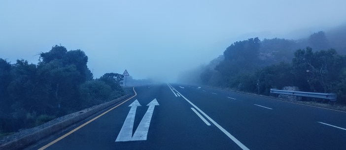
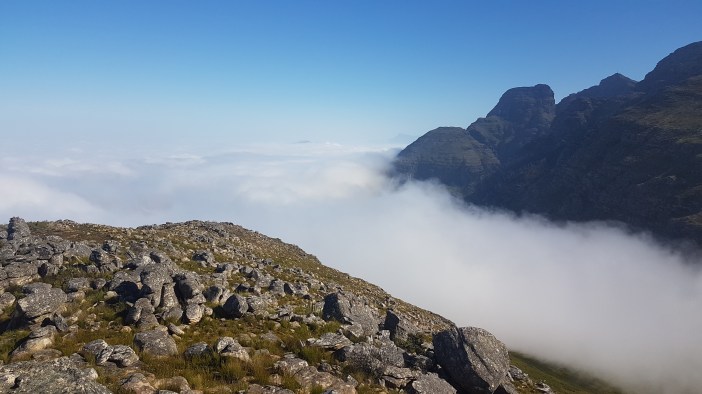
The road was misty, as I ascended up the old pass I was surrounded by thick mist. This had me slightly worried about it all being a miserable slog, but I pushed on. Eventually I popped out the top of the mist and could still kick myself for not stopping to get a photo. A blanket of fog filled the valley but the air above the surface was bright and clear.
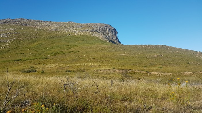
I parked at my usual spot and headed up the hill. My initial plan was just to find a route to the top right hand corner. There are no paths up here but luckily the terrain is relatively easy to traverse as long as you zig and zag enough, and where you need to climb it’s fairly easy to find a route that doesn’t require doing anything too stupid.


As you scramble up there rocks there are various “false summits”. You see what looks like the top and climb to it, and then when you’re there you see there is a another one a few minutes scramble away. The entire time the view is getting increasingly spectacular.

Eventually things flatten out into an undulating plateau that seems to go on forever. (This is the Hugenot Ridge, a 3 km spine of mountain in an almost straight line… which has made it onto the list for future adventures)


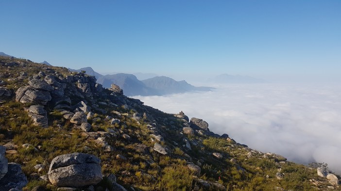
Once on the plateau things, err, flatten out and you can basically just take a stroll with the occasional scramble that requires using a hand to steady yourself. I truly felt like I had found something secret. A little world that was was hidden in plain sight, just off the road, but I was a million miles from everyone.

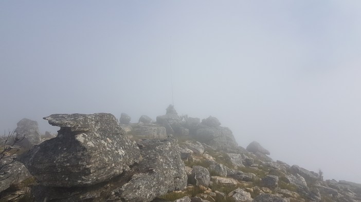
I kept walking towards the obvious “highest” point and when I was close enough realised that it was a rock cairn, possibly a minor surveying point but maybe just erected by enthusiastic hikers.

The cairn offered an obvious spot to erect my mast and with the warmth of the sun baking through the chill, and absolutely no wind I decided to make this place my home for a few hours.

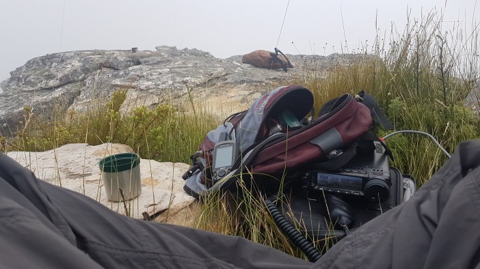
Getting the mast up was pretty quick. I’m getting good at that. I did notice that it was starting to feel a bit chilly. The mist was rolling in… It made me a little bit nervous, but the route down was relatively straightforward and in a worst case scenario I had a GPS track I could double back on.

The radio’ing was great. I chatted with all the usual suspects including some Namibian guys on 40m and then decided to switch over to 20m where to my amazement I was hearing foreigners chatting quite clearly (which is sometimes a sign that they might hear you. It worked. In a matter of minutes I had spoken to a guy in Northern Italy, a guy in the Congo and another guy in Brazil. Incredible, and all while surrounded with fog!

The fog was thick enough that I had to start covering my kit. I hike with a large lightweight waterproof tarp that usually serves as a roof when the sun is baking down, but can also be used as a cover over my kit with a few rocks holding it down and creating an opening so that I can still read the display etc.
I spent a few hours up there with my coffee and rusks, and a sandwich when I felt hungry. I can easily imagine spending the night up there if I could find a flat enough spot to make a bed. My clothing was damp from the fog, but not enough to be uncomfortable. I now hike with a compact raincoat for such occasions.

Eventually my coffee ran out, and my battery beeped its low voltage alarm, and I decided to pack up and head back. The weather seemed to be playing along, clearing during my pack up and opening up the view for me on the way back down.


And this is why I have a new saying: “I’ve never regretted a hike”, and to think, I was contemplating spending the day on the couch!
Summary
Date: 23 December 2018
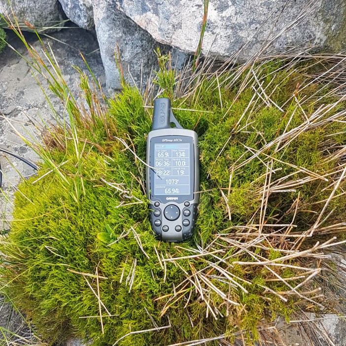
Distance and Elevation: 2km and 200m Elevation Gain.
Coordinates: Parking spot -33.696697, 19.074741 Rock Cairn: -33.700637, 19.071358
Conditions: Heavy fog rolled in, make sure you take a waterproof shell. I imagine it could also be blisteringly hot with gale force winds, possibly on the same day. Be prepared.
Radio Stuff: You’ll definitely need a mast, great location for radio.
Route: KML File (approximate)
Notes: Don’t ever debate hiking.
