It is ironic that I never really thought of Cape Point as a hiking destination. It has always been the place where your friends from overseas go on the day you’re not playing tour guide.
It was the two SOTA summits inside the reserve, tantalisingly close to each other, that convinced me to go for it. This would be the longest hike since I left my 20s, and I planned it with two cars so that we would have an easy out before the second summit if we decided to bail early.

My hiking companion StJohn and I made sure we were the first people at the reserve gate at 6am when the main gates opened. We dropped off one car at the base of Vasco da Gama peak and then backtracked with the other car to the parking spot nearest Paulsberg.
Paulsberg (368m)
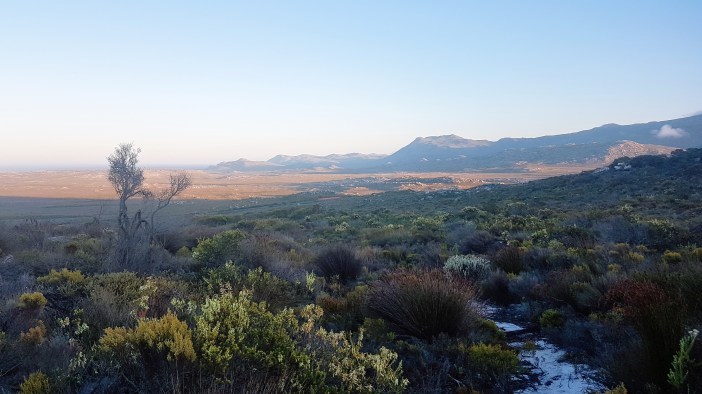
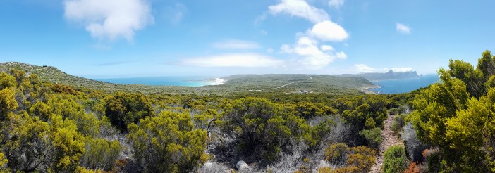
It was misty and windy but the hiking was good. We trundled over the gentle hill that separates the road and Paulsberg, and then started climbing up to the summit. The wind was picking up, and as we ascended the view behind us would be wiped away by walls of mist and then occasionally clear enough for us to get a sense of our progress uphill.
The summit of Paulsberg is roughly 210m elevation above the parking spot. We’d covered the first 100m of elevation over the previous 1.5km, but now with less than 500m of distance you’re gaining 110m of elevation. It is steep but not unmanageable if you pace yourself.
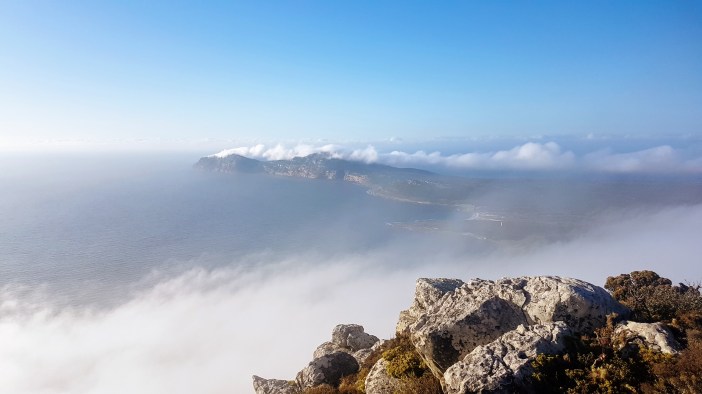
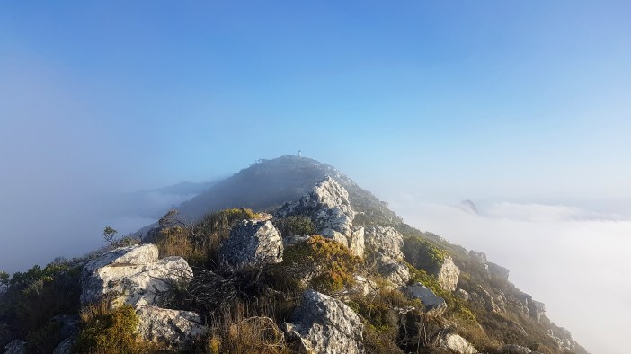
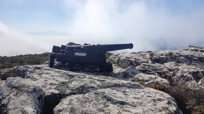
The wind buffeted on. I wondered about the success of our antenna erecting abilities in the strong wind. The trail reaches the “top” about 100m South of the actual highest point, from there you scramble across the slight incline to the survey beacon. We took a few moments to assess the situation and plan our attack.
I’ve subsequently realised that the approach I took to getting the antenna up was not ideal, and hopefully you can learn from my frustrations. Firstly I must highlight that the wind was strong and gusty. I imagine that the steep cliff-face played havoc with the wind direction and we seemed to be getting gusts from every direction.
What I did: Strapped the fully telescoped mast to the survey beacon and then tried to use the guy lines to keep it up straight while the wind buffetted it in every direction, tangling all the lines, having the mast de-telescope randomly and then having to reset over and over. It took ages and I was constantly worried that a gust would snap my expensive mast.
What I (think I) should have done: Get the mast up and use the legs of the inverted-v antenna to pull it over in one direction, preferably into the direction of the predominant gusts so that it is flexed into the wind (not away from it). This should, in theory give you much most stability, but yes your (flexible) mast will be bent and you do obviously run the risk of snapping it. The theory is that doing it this way reduces the risk of snapping because the mast is held in a static position. The other (theoretical) side effect is that you’ll have less de-telescoping because the side-loading should resist the mast sections slipping through each other. Did I mention that this is a theory?
We eventually managed to get the antenna up and in the windy chaos got the required 4 contacts for SOTA. In the process I managed to lose my phone, find it again and then once we pulled the mast down realised that I didn’t have a single photo of the antenna in place. I felt relief to not have broken anything which is not a great feeling.

We packed up, had some coffee, adventured to the edge of the crazy steep cliffs overlooking the sea and took some photos. This was just the first stop for the day.

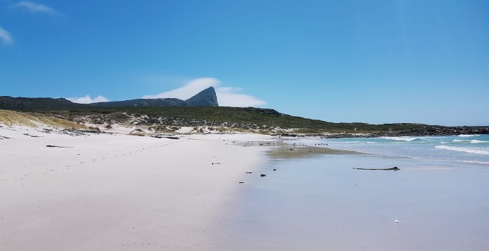
Descending Paulsberg was relatively quick, not easy, but quick. We joined up with the main path and started heading down the Bordjiesrif Trail which gradually takes you down to the sea. It’s a lovely walk and the weather cleared as we descended. It felt like summer by the time we stepped out onto the tarred road on the beachfront.
I have this thing: I want to put my feet in the water. I feel like we go through life trying to keep our feet dry. I walked to the rocks, took off my shoes and socks and then gingerly hopped to a spot where I could sit with my feet in the ice cold water. Magic! My hiking buddy gave into the peer pressure and did it too. (yes, I’m sure there’s lots of reasons not to get your feet wet while hiking).

Once we had our shoes back on we started walking the beach road towards the next summit, Da Gama. This was a long stretch, but very flat and the groups of people swimming in the tidal pools and braai’ing next to their 4 person dome tents (that they set up for the braai, probably to keep granny out the sun) made the walk seem faster. They probably thought we were weird, hiking with our huge backpacks through their braai area!


About half way between the peaks we left the road and continue hugging the coastline. This wasn’t the easiest route to the base of Da Gama, but it was the prettiest… except for the months-old beached whale that I won’t be sharing a photo of.


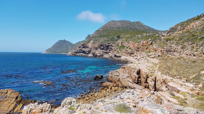
We eventually picked a spot to eat even though I generally don’t feel like eating on hikes but know I must. It was windy again and the gusts threatened to tsunamis in my coffee cup as I sipped away. We realised we had gone too far and needed to double back a bit to to get back to the trail we needed to be on. A few minutes of bundu bashing uphill and we were back on the right trail. We skirted the steep cliffs that crash into the sea and form the base of da Gama. If there was an inaccessible cave with hidden pirate treasure, it would be right here, including the “Danger Do Not Enter” signs.


We popped up off the trail right into the parking lot where we had parked our second car. (yay navigation skills). I didn’t let myself think too hard. My feet were aching. My right knee clicking with each step, the blisters on blisters on blisters from the last 12 weekends of hiking were begging for the luxury of the Volvo’s leather seats and air conditioning. I walked towards to Southern side of the parking lot looking for the trail that heads to the summit. Casually I ask StJohn “You’re good to to go? Right?” – I didn’t want him to over-analyse either. This wasn’t about “wanting to do something”, it was about finishing what we started.
Vasco Da Gamma Peak (250m)
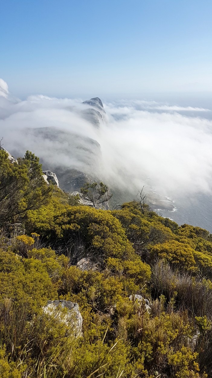
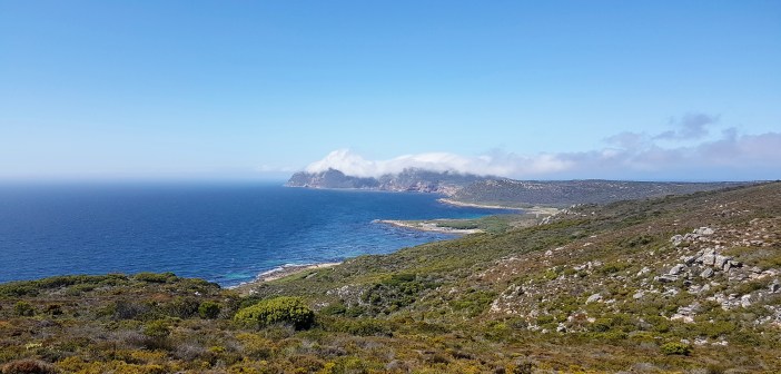
The climb up Da Gama was slow. It’s a weird climb because it skirts the peak around the eastern side and often feels like you’re walking in the wrong direction. The weather would oscillate between zero wind and then an occasional breeze. We slogged up. The views looking back up the peninsula are spectacular. The Indian and Atlantic oceans choosing different colour schemes for the day. (It’s not because they’re different oceans, just local conditions, sometimes they look the same).
As you get closer to the top you start to see derelict fence posts in the middle of nowhere. That alone is a bit spooky, but as you continue hiking you realise that there really is no actual trail to the summit, just fence posts that once very-seriously fenced off the entire top section of the peak. I had no idea what to expect up there (I didn’t do enough research) but I started to get the impression that it was going to be something related to the military and probably of WW2 era.
Eventually we realised that the only paths we could find led away from the summit, so the only thing left to do was to leave the path and scramble the last hundred meters up the hill. We made our way up, and then as you emerge onto the summit you see a series of very derelict cabins, and most notably a large concrete base about 5m square with rusted iron inserts that makes it look very much like it held up some sort of communications equipment. A beautiful coincidence that we would be there to play with radios.

Subsequent research has taught me that this station was the Da Gama Radar Station, which was built in the early days of WW2 along with many others along South Africa’s coastlines in order to act as an early warning system for approaching enemy aircraft (as possibly ships). Frustratingly there are almost no photographs (online) of what these bases looked like, and I can’t not find any photos of this particular base from when it was still operational. I’m sure they exist in some granny’s notebook or an archive folder that was never digitised, but as of now it’s a piece of history that we might lose forever.
The wind was still pumping. I didn’t feel like going through the frustration (and fear of breaking things) that we had earlier at Paulsberg, and this time we had tall man made structures that were begging for an antenna to be strung across them. It was already getting late in the day. I shared my plan and StJohn and I started executing it. In truth it was a bit of a shambles. Scrambling between the buildings through thick bush, dodging thorns and asbestos roof sheeting. Throw lines that repeatedly got stuck, or were blown off course, lines pulling lose… Our exhaustion by this point also made it increasingly less likely that anything would go right the first time, so there were a few minutes of Laurel and Hardy, but eventually we had a working antenna system strung between two of the derelict buildings.

The radio was busy. there was a competition (contest) going on where people from all over Southern Africa were trying to all speak to each other and earn points for each contact. You would think that this would make getting the 4 required contacts easy, but it actually made if harder since there was just so much going on it was hard to get a word in edgewise.
Finally we got the fourth and then fifth contact, it was anticlimactic. The drudge of the day was starting to catch up with our enthusiasm. We had however done it! Two never before activated summits, over 14km hiking, 10 HF contacts, feet in sea in between, and lots of lessons learnt ready to be put in practice next time.

We packed up quickly. It was already 3pm and we had been hiking for 9 hours and still needed to descend. On the way down from the radar station I found a hint of a scrambling route which might make returning a bit easier. The hiking trail is in good condition and made dragging our bodies downhill a bit easier. I don’t remember much from the walk and only took one blurry photograph, testament to how I was feeling by then, and eventually we were standing next to the car.
It’s at this point that I usually start evaluating the day and deciding whether it was a good hike etc. This was tough, but definitely worth the effort and I’ve already made plans to return to da Gama Peak and spend more time there.
Summary
Date: 9 February 2019
Distance and Elevation: 14.5km and 540m Elevation Gain.
Coordinates: Leave Car 1 here, Car 2 parks here, Head to Paulsberg, Down Bortjiesdrif Trail, feet in the see here, head north hugging the coastline until here, head up to where you parked car 1, hike up the trail to here and then scramble the last 50m up to the summit.
Conditions: Thick mist, high winds, sunny and hot.
Radio Stuff: There is a survey beacon at Paulsberg for your mast. The radar station has various structures to use if the wind is too strong, but on a nice day you can appropriately erect your mast on the old radar tower’s concrete base (with guy ropes).
Notes: Perhaps the combination of the two summits was a bit of a tall order, but individually they are both relatively easy hikes and offer great views and exploring. I’m definitely going to return to both.
