The Paardeberg packs a lot of opportunity into a tiny mountain range. There’s a thousand different routes and something interesting around every corner. I had done some exploring in the area a few years back and had a reasonable sense of the trails but decided to just start hiking and see where things led me on the day.
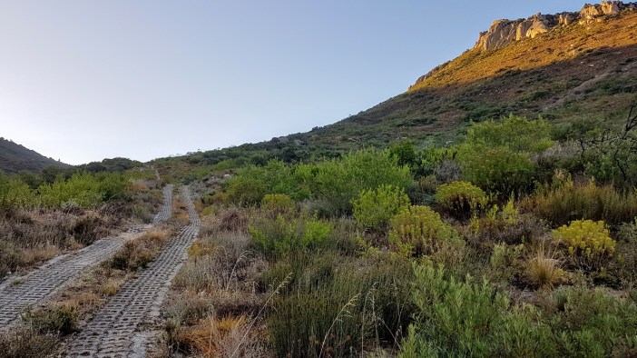
We started from Fynbos Estate (which looks like a wonderful wedding venue) who graciously gave us permission to hike from their land. We headed up the valley via the steep jeep track while the sun slowly rose from the east, illuminating the towering Sonkop cliffs to the west. The ground was wet from overnight rain; yet another miraculous weather change at the last minute enabling one of my hiking missions. It was cool with absolutely no wind. The sound of baboons (I hope those were baboons) arguing on the cliffs above, occasionally sounding creepily human and making you wonder if someone might be calling out to you.

The path winds its way upwards and soon you’re looking down on those baboon cliffs and the horizon begins to spread out in every direction. At the first major fork we turned right (left takes you to Dragonridge and some radio masts but we wanted more altitude).
The route alternates between wide open veld and lush fynbos forests that engulf you as you walk through them. I was hot from all the climbing and dragged my arms through the refreshing tall grasses, still wet from the earlier rain, no fancy spa treatment could compare!
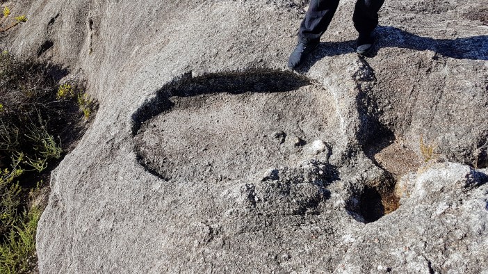
We explored some rocky outcrops just off the path while sipping the first cup of coffee. My love (and ignorance) for geology growing with every adventure. Weird shapes that must be formed by water? How? How long ago? Surely I’m the not the first hominid up here wondering the same thing?

One possible outcome of this hike was to get all the way to Kanonkop which we could now see in the distance, but truthfully neither my hiking partner or I had any interest in adding another 10km to our hike only to reach a spot covered in electrical boxes and radio masts.
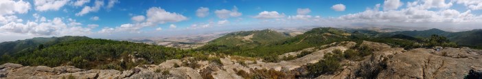
We decided to rather head to a huge outcrop of rocks perched on top of a hill, but weren’t sure how to get there so carried on along the path to see where it went (always a good idea). At the top we were greeted by another spectacular panoramic view of the valley, with Kanonkop on our right and the Paarl Valley spreading out around us.

From the lookout point this path clearly headed in the direction of Kanonkop, but with no clear route to the rocky outcrop that we wanted to get to. We decided to backtrack and look for a way up. We didn’t find one so were forced to bundu-bash a short distance through some thick vegetation to get there. My hiking companion was not impressed by this but I kept reassuring him that it’s a great story to tell, especially the part about how his crazy friend dragged him through a thorny forest for no specifically good reason.

From the top of the rocky outcrop you get yet another incredible view, this time of the Perdebergdam and the valley surrounding it. It took me a while to realise that this was the dam that I had visited a year before when exploring the area. It is funny how your orientation can snap into place when you add context.
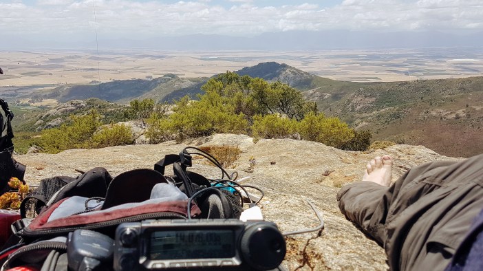
It was a bit windy and slightly chilly. We set up the antenna and I started making contacts while my hiking partner explored the area looking for an easier route down.
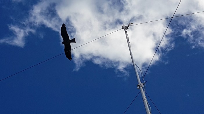
A few minutes later we noticed that a black kite was circling us. At first it just seemed like a coincidental fly-by, but then it circled again, closer, slower, intently looking at us. We started taking pictures thinking that any second now it would fly away. Instead, for 15 magical minutes, it circled us, round and round, flying lower and slower. So close that when it was at the same height as us we could see it’s eyes moving back and forth as it tried to figure out what we were up to. Eventually we must have become boring and it drifted off into the distance. I like to think we’ll meet again.

We spent the next hour discussing our bird friend and talking to people across South Africa and Namibia. The weather closed in on us a bit and it seemed like a good segue to packing up and heading back down.
This is a really magical part of the Western Cape. On a map the entire mountain range is a small green dot, but hiking here is a world of its own and gives you context for how big this country really is and reminding you how many more adventures there must be out there in other small green dots on the map.
Summary
Date: 12 January 2019
Distance and Elevation: 7km and 405m Elevation Gain.
Coordinates: Start Fynbos Estate (get permission!) Rocky Outcrop: -33.5809308, 18.7983747
Conditions: Cool in the morning with a strong breeze later in the day. The shady valleys on the way up can get chilly.
Radio Stuff: You’ll need a telescopic mast. There aren’t well situated trees to string anything up.
Notes: I’d like to go back and do a longer route, perhaps one that traverses the entire mountain range in a day.


Man, I wish I was your “hiking partner” on this one. Well written, awesome pics!